Botswana Geography
Botswana is some 581 730 square kilometres in extent (making it similar in size to Kenya, France or the US state of Texas), and is completely land-locked. In fact the entire country is part of the vast Kalahari basin (formed millions of years ago), which subsequently filled with sand and debris.
The Kalahari is the largest continuous stretch of sand on the planet, but as much of it is classified as arid (between 250 and 450 millimetres of rain per annum), it is not actually desert. The country is surprisingly flat, but there are some fascinating rocky outcrops along the eastern fringes (notably in the beautiful Tuli Block). To the west of the Okavango are the famous, and culturally significant, Tsodilo Hills (which mark Botswana's highest point at 1 489 metres above sea level). The average elevation of the country is 1 100 metres above sea level.
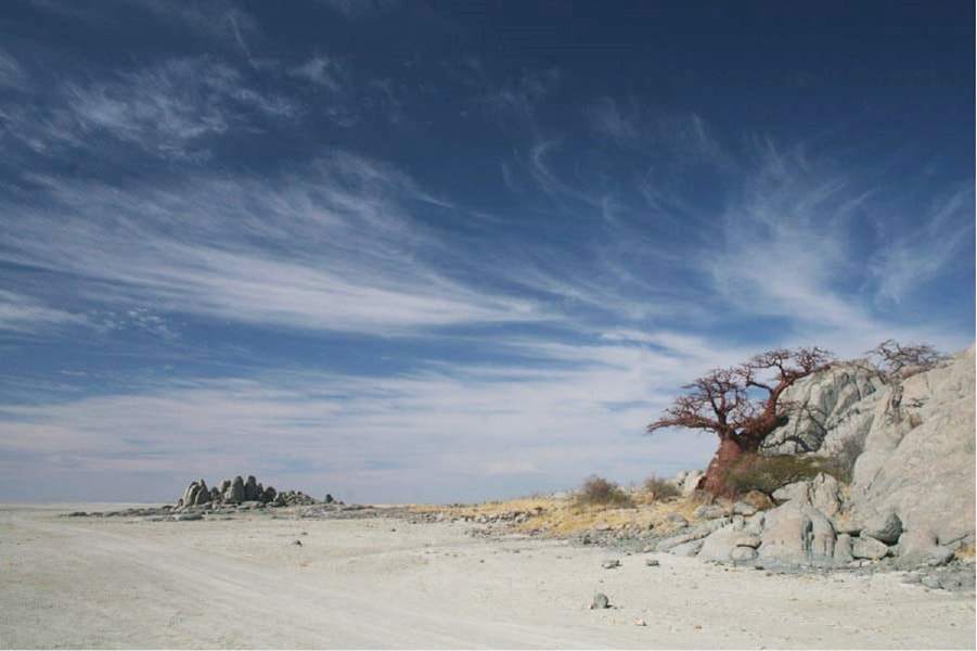
The vast (at its fullest extent it would have covered the Okavango, Nxai Pans, and Lake Ngami) and other-worldly Makgadikgadi Pans to the south east of the Okavango were once part of a vast inland sea, but now only hold water during the rainy season. By 10 000 years ago the sea was already drying up.
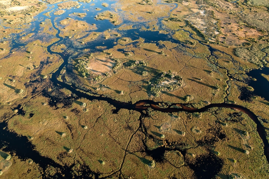
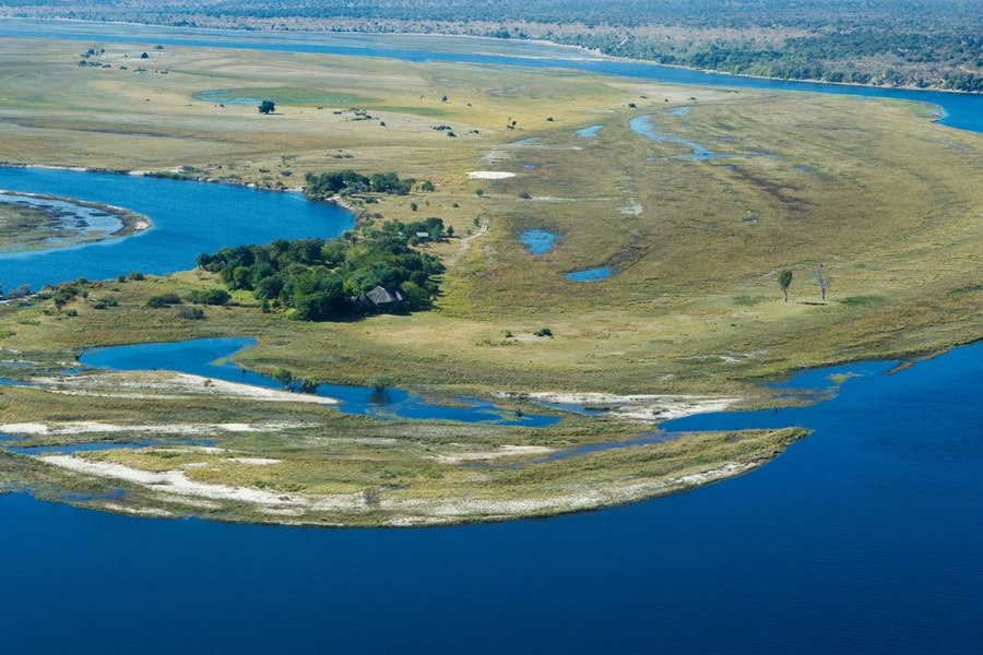
As Botswana is seismically more active than one might think, much of the modern landscape has been formed due to fault lines such as the Gumare Fault which Is the Southern-most point of the Great Rift Valley. This fault runs across the panhandle of the Okavango, and once the River has crossed it, it fans out to form today's Delta. The flow is arrested by a parallel fault, the Thamalakane, thus causing the formation that you see today. Some water still flows out of the Delta, in the Thamalakane River.
It was a shift in the underlying crust that caused the Okavango's flow to change in the first place, as its waters once feed the mighty Zambezi River.
From the point of view of economics, perhaps Botswana's most important geological find was the Kimberlite pipe at Orapa (making it the world's second largest diamond pipe). Further pipes were discovered at Jwaneng and Letlhakane.
The Kalahari is the largest continuous stretch of sand on the planet, but as much of it is classified as arid (between 250 and 450 millimetres of rain per annum), it is not actually desert. The country is surprisingly flat, but there are some fascinating rocky outcrops along the eastern fringes (notably in the beautiful Tuli Block). To the west of the Okavango are the famous, and culturally significant, Tsodilo Hills (which mark Botswana's highest point at 1 489 metres above sea level). The average elevation of the country is 1 100 metres above sea level.
The vast (at its fullest extent it would have covered the Okavango, Nxai Pans, and Lake Ngami) and other-worldly Makgadikgadi Pans to the south east of the Okavango were once part of a vast inland sea, but now only hold water during the rainy season. By 10 000 years ago the sea was already drying up.
As Botswana is seismically more active than one might think, much of the modern landscape has been formed due to fault lines such as the Gumare Fault which Is the Southern-most point of the Great Rift Valley. This fault runs across the panhandle of the Okavango, and once the River has crossed it, it fans out to form today's Delta. The flow is arrested by a parallel fault, the Thamalakane, thus causing the formation that you see today. Some water still flows out of the Delta, in the Thamalakane River.
It was a shift in the underlying crust that caused the Okavango's flow to change in the first place, as its waters once feed the mighty Zambezi River.
From the point of view of economics, perhaps Botswana's most important geological find was the Kimberlite pipe at Orapa (making it the world's second largest diamond pipe). Further pipes were discovered at Jwaneng and Letlhakane.